
Trace an East Fishkill Street
An East Fishkill street directory begins with the exact address, not a name. Confirm the address in ParcelAccess, preserve the parcel number or grid, and distinguish the Parcel Location from the Primary Owner Mailing Address. The parcel card supplies a current ownership and assessment lead, plus a deed book/page pointer. It does not say that the owner is physically present at the situs. That distinction keeps the street-by-street trail accurate.
Next, use the parcel's book/page and owner name to find recorded instruments. The deed chain supplies legal title events. A limited voter check can corroborate a known registered-voter identity, but it is not a street roll. Historical directories and newspaper issues provide dated listings after the property and deed keys have been established. This sequence keeps address evidence, recorded parties, and historic listings from being mixed together.
- Verify the full street address in Dutchess County ParcelAccess, then record the municipality, parcel or grid, situs, and mailing-address difference.
- Open the property card and retain the owner, assessment-roll vintage, deed book/page, parcel-history link, and any filed-map reference.
- Search the County Clerk index for the current owner as grantee, then inspect the latest deed and its earlier reference.
- Work backward through grantors, grantees, document types, legal descriptions, and prior book/page citations until the online coverage limit appears.
- Use the New York voter service only with a known last name, first name, birth date, county, and address or ZIP.
- For a past address trail, compare a verified directory or newspaper listing with the parcel and deed chronology.
Note: Record the access date and the search mode, because a street name, parcel boundary, or displayed owner detail can change over time.
East Fishkill Street ParcelAccess
ParcelAccess is the official map-first tool for the East Fishkill street directory. Use Find a Parcel, the Search tab, or a map click, then keep the parcel identifier exactly as displayed. The property card returns parcel number, associated grid numbers or lease codes, Parcel Location, municipality, owner name, Primary Owner Mailing Address, lot size, land use, assessment, market value, school district, agricultural district, roll section, tax code, and Deed Information Book/Page. It also links to the Full Property Card, Parcel History, Filed Map, tax rolls, historical aerials, and zoning resources.
The ParcelAccess map shows the search, parcel-card, and layer workflow used for East Fishkill addresses.
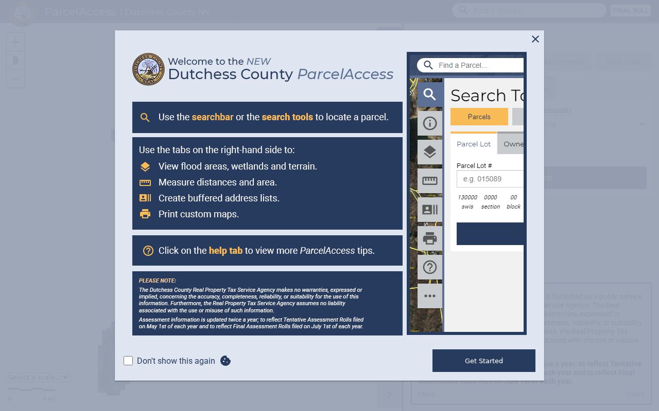
The map is an address and parcel tool. It gives a reproducible property starting point, not a claim about every person connected with a road.
| ParcelAccess field or control | Type | Use and limits |
|---|---|---|
| Find a Parcel / address-owner search | Search control | Use an address, owner, parcel, map click, or Search tab entry; exact first-screen labels vary. |
| Municipality | Dropdown | Optional in advanced searches; East Fishkill is selectable, while the complete live list was not captured. |
| Property Class and Building Style | Dropdowns | Optional advanced filters; use the current portal options rather than assuming a fixed list. |
| Bedrooms, Living Area, Lot Size, Year Built | Dropdown or text range | Address-adjacent research filters, with area in square feet and lot size in acres. |
| Sales Date Range | Text range | Available in the residential-sales search only. |
| Map Number | Text | Required for a filed-map query where an indexed development plan exists. |
| Buffer, Parcel Select, Point Select | Map controls | Nearby-parcel tools; Parcel and Point Select use 100-foot definitions. |
| Print Labels, Download CSV, Print Map | Buttons | Create a dated working output, not a certified survey. |
East Fishkill Situs Checks
A street directory search should preserve four separate keys: the supplied street address, the parcel situs, the Primary Owner Mailing Address, and the parcel/grid. ParcelAccess warns that the address can differ from the parcel address and directs users to the official Address Info Finder. Non-situs records cannot be mapped, and the municipal assessor is the correction route. A Hopewell Junction or other postal label may also cross municipal lines, so postal city and civil town should not be treated as the same field.
For a road segment, Parcel Select returns parcels within 100 feet of a clicked parcel and Point Select returns parcels within 100 feet of a clicked point. A Buffer, Line Sketch, or Polygon Sketch can extend the selection. Download CSV, Print Labels, and Print Map preserve the selection mode, map date, and output. The measurement tools are not survey-grade, and the result is a geographic parcel inventory rather than proof of a legal boundary or personal presence.
Compare the nearby cards one by one. Owner names, mailing addresses, land use, lot size, deed references, and parcel history can show a pattern worth researching. They do not establish that a shared mailing address, nearby lot, or common name identifies a single individual.
East Fishkill Deed Chain
The Dutchess County Clerk search supplies the recorded-instrument side of an East Fishkill street directory. Search party names surname first, with all or part of a name. Capitalization, punctuation, and spaces are normalized, so variants such as OConnor, O Connor, and O'Connor are treated together. Starts With, Contains, and Does Not Contain modifiers are available, and up to three criteria can be combined. Search both grantor and grantee roles, then repeat exact trust, estate, or entity names when they appear in an instrument.
The County Clerk document-search guidance explains the historical and regular coverage split and the image rules.
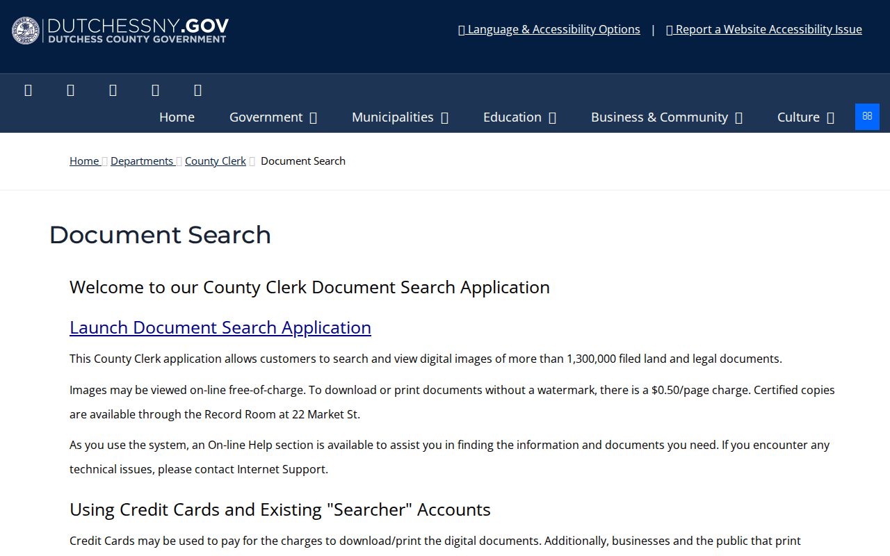
Deeds run from July 7, 1907 through December 31, 1988 in historical search and from January 1, 1989 forward in regular search. Images can be viewed free, while unwatermarked downloads and prints cost $0.50 per page.
The live Dutchess party-name document search displays the result columns and document controls.
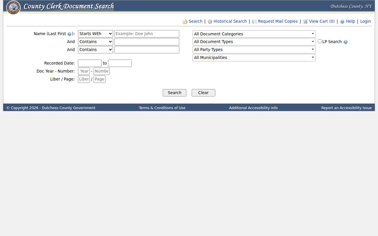
Results can show Party Name, Type, Year, Doc #, Liber, Page, Municipality, Party Type, Date Recorded, Comment, and Complement Name. Open the image or information view, copy the legal description and prior reference, then search backward. Certified copies come through the Record Room; supporting exhibits can require a mailed request.
East Fishkill Address Records
Address-keyed sources have different strengths. ParcelAccess is strongest for a current property identity. The document index provides recorded parties and legal activity. Tax and permit routes add administrative context, while voter service is limited to one identity-based result. Historical sources add a dated printed listing. Read them as a chain, not as interchangeable proof.
| Address record | What it can show | Keeper | Access and caution |
|---|---|---|---|
| ParcelAccess / assessor | Parcel, situs, owner, mailing address, land use, assessment, deed book/page | Dutchess County and East Fishkill Assessor | Free map and roll links; owner or mail field is not physical-presence proof |
| County Clerk documents | Grantor, grantee, instrument, date, liber/page, legal description | Dutchess County Clerk | Deed coverage uses historical and regular search modes; copies have fee rules |
| Tax roll / Receiver | Assessment, tax status, district, billing clues | East Fishkill Receiver of Taxes | Town roll links or office route; billing data is not a personal-location finding |
| Permit and zoning files | Property, project, applicant, owner, or current-use details when a record is available | East Fishkill Building and Planning | Online application route and office request; public result coverage was not verified |
| Voter lookup | One registered voter's service result | New York State / Dutchess BOE | Known identity inputs required; no bulk street roll |
| Directories and newspapers | Dated address, road, hamlet, or subscriber clues | Libraries and historical repositories | Discontinuous runs; listing is limited to its publication date |
Note: Parcel number, legal description, and deed book/page are the most stable bridges when a road label or postal city creates ambiguity.
East Fishkill Permit Requests
The East Fishkill permit route offers general and project-specific packages, pre-site inspection, staff plan review, permit issuance, inspection scheduling, and final inspection or certificate steps. Delivery can be through the online OpenGov route, mail, the vestibule drop box, or in person. The source did not establish a public address-search result database or a historic coverage range, so ask Building and Planning for a specific address or project rather than claiming that every record is online.
Zoning verification is an address-to-parcel request, not an instant lookup. The request asks for subject-property address, parcel or tax-map number, owner of record, current use, applicant information, statement recipient, and comments. It also calls for a survey or recorded plat signed and sealed by a registered engineer or surveyor, a site plan, payment, and at least 30 days of lead time. It can clarify an address and official parcel connection when the map label is uncertain.
East Fishkill Voter Address Check
The New York voter lookup is a limited identity check after a street and person have already been identified. Visible fields are County, Last Name, First Name, Date of Birth, and ZIP Code, with address information used by the service. Choose Dutchess County and preserve the date of the returned result. A valid response is a current registration or poll-service clue, not ownership evidence and not a list of every person on the road.
For existing election records that are not available through the form, the Dutchess County Board of Elections is the administrative route. Its FOIL form supports specified records and dates. Identify the election year, municipality, election district if known, and fields sought. FOIL does not require the agency to create a new by-street roster, and confidential registrations or other exemptions can limit release.
East Fishkill Road Names
Street research needs a date check because a current road name can differ from an earlier record. On February 9, 2023, the Town Board approved the change of North Drive at the former IBM East Campus to Chester Way after a Dutchess County 911 duplicate-name check. Search both North Drive and Chester Way when a deed, directory, permit, map, or newspaper item falls around that change. A parcel/grid and legal description help connect the two names.
The historical baseline is older still. East Fishkill separated from Fishkill on November 29, 1849, and the original boundary map, FM No. 117, was filed with the Dutchess County Clerk on July 22, 1850. It records roads, bridges, and original boundaries. No municipal town-wide street-renumbering project or year-by-year number-conversion list was verified. Do not invent a renumbering date; use former road names, hamlets, parcel history, and Planning or 911 questions where an address sequence changes.
East Fishkill Historic Streets
Historic street evidence is incomplete by design. The 1866 Fishkill sketch-and-directory, the 1922-23 and 1924-25 Beacon, Fishkill and Glenham directories, and the 1950-51 Beacon Telephone Directory are regional leads rather than a continuous East Fishkill street directory. Directory titles and postal labels can point outside the present town, so compare the printed road or hamlet with the 1850 boundary context and a modern parcel. A telephone or directory entry records a publication-date listing, not a current fact.
The East Fishkill Community Library can route local-history questions, while Blodgett Memorial Library offers a Fishkill-area closed local-history collection with appointment and exact-item access. Newspaper holdings include the Fishkill Weekly Times, Hopewell Junction Bugle, East Fishkill Record, and Southern Dutchess News in repository-specific runs. The regional collections and their known gaps are handled in the East Fishkill city directory.
- Parcel
- A county-defined land unit with a map position and identifying number or grid.
- Situs address
- The physical parcel location used for assessment, mapping, and zoning, distinct from a mailing address.
- Plat
- A recorded map or plan showing lots, roads, or subdivisions; the filed map number is its search key when indexed.
- Criss-cross directory
- An address-led directory section, when a verified volume has one, used to locate a dated printed listing by road and number.
East Fishkill Street Limits
An East Fishkill street directory can connect address-based records, but it cannot turn them into a full account of everyone associated with a road. Parcel cards identify property and owner information. Deeds document a transaction. A voter result requires identity inputs. Permit files, court records, vital records, DMV information, protected addresses, and confidential registrations each have separate access rules. A missing result can mean an unindexed, protected, wrong-jurisdiction, or unavailable record.
Lawful use. Use East Fishkill street records for lawful personal research, family history, estate matters, civic questions, and source verification. Do not use address data to stalk, harass, intimidate, or harm anyone.
For a record that is not online, request the existing document from the right custodian. New York FOIL covers reasonably described existing agency records and generally requires a grant, denial, or acknowledgment within five business days. It does not require an agency to create a new street directory, and court files are requested through the relevant clerk under separate court rules.